Epsom Downs (properly known as Epsom and Walton Downs) is an extensive area of chalk downland just south of Epsom in Surrey. At its core is the renowned Epsom Downs racecourse, best known for the annual Derby. The downs are also important both for public recreation and the training of racehorses, and are managed by a board of conservators.
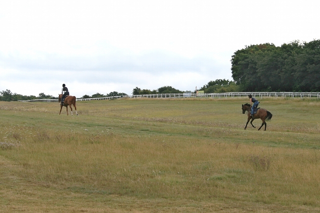
 This webpage explains the opportunities available for horse riding on the downs.
For reports and comment about riding on the downs, please see the blog.
A hack area alongside the home straight |
There is a right of access on horseback to hack areas and over 20km of rides on the downs. In addition, there is access along several public bridleways and Walton Road (an unsurfaced road). Use of some of the hack areas and rides is excluded during the morning (until noon) to reduce conflict with the training of racehorses, but plenty of other areas and rides are available all day. Access along the public bridleways and Walton Road is also available at all times (even where these are adjacent to or cross the training areas). Strictly speaking, the hack areas and rides are for the use of riders and walkers: cycling is not permitted except on the public bridleways, Walton Road, and a few other routes designated for cycling. But don't be too surprised to meet cyclists anywhere on the downs. |
There are extensive hack areas on the downs, where riders are free to range over the designated area at any pace, often on firm, well-drained, turf. The best hack areas are:
but there are many smaller or less valuable areas elsewhere.
You can see the location of the hack areas on this copy of the signed map: they are marked by grey hatching (note that the areas coloured pink are reserved for racehorse training). Some hack areas south of the racecourse are closed to riders before noon each day: they are marked between consecutive pairs of letters on the map (e.g. between 'C' and 'D'). Not all the hack areas are in good condition: several areas have been allowed to degenerate into dense scrub. For example, parts of the triangle east of Downs House have long, rough grass and scrub, and use by horse riders is generally confined to one or two paths across the area (although recent clearance work here and elsewhere has improved the situation).
The downs are criss-crossed by designated hack rides. The hack rides extend also around the golf course to the north of the racecourse. Some hack rides south of the racecourse are closed to riders before noon each day: they are marked between consecutive letters on the signed map (e.g. between 'A' and 'B'). Hack rides are shared with walkers, but it is technically illegal for cyclists to use them (under the downs byelaws) except where the hack ride follows a public bridleway. You can see the location of the hack rides on the signed map: they are marked by grey dashed lines.
Both hack areas and hack rides are marked by posts — but there aren't many of them where you most need them.
A blue arrow means you can ride in the area facing the arrow;
a red cross means you can't ride in the area facing the cross; a yellow arrow means you can ride in the area facing the arrow, but only after noon. In the photo on the right, taken on Old London Road, there are blue arrows on the sides of the posts facing into the track, to show you can ride along it, but red crosses on the outsides, to show you oughtn't to stray off the track. (There's another blue arrow on the side of the nearer post, to show you can ride on the track leading towards the camera.) This post is quite new: some are pretty old and the markings barely legible. There is a programme underway to update signposting on the downs.
The downs are also crossed by several public bridleways, such as the Old London Road (see photo, below) and an unsurfaced public road (Walton Road). The bridleways and road can be used at any time. Walton Road runs south from the Rubbing House across the downs to the bottom of Ebbisham Lane: it is surfaced only as far as Downs House Road. The bridleways are not specifically identified on the signed map, but can be seen on the extract from the Ordnance Survey Explorer map opposite (marked by the longer green dashes). Walton Road is not labelled on either map, but can be seen on the Explorer map extract marked by orange dots where it crosses Walton Downs, then continuing north to the marked public telephone (which no longer exists).
Old London Road |
Image (right) produced from the Ordnance Survey Get-a-map service. Image reproduced with kind permission of Ordnance Survey. |
If you're coming to the downs in a horsebox, the best place to park is the Mile Post car park: it's just inside the race course on the south side of The Hill. To reach it, turn off Tattenham Corner Road (B290) at the roundabout with Old London Road, cross the racecourse, and follow the road round to the left parallel with the racecourse. Park at the car park on the far side of the Hill. The road inside the race course is closed every evening: watch out for signs about the closing time.
Alternative parking places can be found on Grand Stand Road (but space tends to be limited), in the Tattenham Enclosure (off Tattenham Corner Road, when open, grass surface) or off Langley Vale Road by The Rubbing House (but the pub is now so popular that this is not now recommended — even if there's room when you arrive, there may be no room to load up when you want to leave). Epsom and Ewell council has published in Word format a map of car parks on the Downs.
The board of conservators have made byelaws (pdf) to regulate use of the downs. Breach of the byelaws is an offence, although prosecutions are very rare.
The byelaws provide that: "3. A person shall not without lawful authority ride a horse on the Downs otherwise than upon the rides and areas shown for that purpose on the signed map and on such other rides or areas as may from time to time be authorised by the Conservators."
The byelaws also prohibit riding on the tracks and areas marked on the signed map between pairs of letters (e.g. between 'C' and 'D') before noon each day (byelaw 4), riding in the vicinity of the racecourse or on the Hill on race days (byelaw 5 — see the Epsom Downs racecourse website for the racing calendar), and riding in contravention of any temporary restriction imposed by the conservators (byelaw 6).
It is not an offence to breach byelaws 3 and 4 unless: "...notice specifying the offence and the maximum penalty therefor is conspicuously displayed in such places on the Downs as the Conservators think fit, and the routes of the rides are clearly identified by signs or other means" (byelaw 21). The byelaws do not apply to the small part of Walton Downs which lies within the borough of Reigate and Banstead.
Just for the sake of completeness, it's also an offence to ride in a public place (that includes the downs) while drunk in charge of a horse (section 12 of the Licensing Act 1872). So you might want to visit the Derby Arms and the Tattenham Corner on separate occasions (the Rubbing House, in the background left of photo right, doesn't admit anyone wearing boots!).
The downs are privately owned, and much of the land is leased to United Racecourses (Holdings) Ltd. But the downs are regulated under a local Act of Parliament — the Epsom and Walton Downs Regulation Act 1984. Under the Act, the downs are managed by the Epsom and Walton Downs conservators. The board of conservators comprises six local councillors nominated by Epsom and Ewell borough council, three nominated by Epsom Downs Racecourse (part of Racecourse Holdings Trust and a subsidiary of the Jockey Club), and one by the owner of Walton Downs, now also Epsom Downs Racecourse. The board meets several times a year, and is currently chaired by Cllr Jean Smith. There is also a consultative committee, which brings together the conservators and representatives of recreational users and local residents. The minutes of meetings of both the board of conservators and the consultative committee can be seen via the website of Epsom and Ewell Borough Council.
Riders' representatives regularly attend meetings of the conservators and the consultative committee: reports can often be found under latest news.
The signed map is identified in the 1984 Act as setting out the areas and paths which riders may use on the downs. You can see a reduced scale copy of the map by clicking on the image (right — file size approx. 600kB).
Note that the areas of the map coloured pink are reserved for racehorse training (whether or not they are in use for that purpose). It is not very easy to relate the signed map to landmarks on the downs. We are asking for better publicity to be made available.
A consultative committee meets twice a year to improve communication between the board of conservators, users of the downs, and local residents. The committee is chaired by the chairman of the board of conservators, Cllr Jean Smith, and includes two representatives of hack riders: one from the British Horse Society (Hugh Craddock) and one from the Epsom Downs Riders Protection Society (Alex Stewart).
Riders have not been very effective in making their voice heard at times in the past, and we are trying to raise their profile. Some of the issues which we are campaigning about are outlined below: please see the blog.
Many of the hack areas, in common with much of the downs, tend to revert to scrub and woodland unless actively maintained. Some of the hack areas marked on the signed map have long since been lost to scrub, such as along the northern boundary of the golf course. Most notably, our concerns relate to:
There has been significant scrub clearance since the winter of 2004-05 and subsequently, and some areas, particularly the hack rides either side of Old London Road, are now much improved and well worth using. But much more remains to be done.
Some really good work has been done on the hack sand track at the foot of Six Mile Hill, to open up the width and improve the surface, involving excavation of the original width, harrowing, and importation of new sand. See the "before" and "after" photos below. There are still concerns about regular maintenance: the adjacent all-weather gallop is harrowed daily, but the sand track is lucky to see the harrow every fortnight.
![]() |
![]() |
The sand track in 2004 |
The sand track in 2006 |
The 1984 Act designated the lowest part of Walton Downs as an area on which hack riding is permitted after noon "if in the opinion of the Training Grounds Management Board conditions permit" (this area can be seen marked in hatching on the map). It seems that the Board has never concluded that "conditions permit". Much of the designated area is also covered by scrub.
The Board is currently saying that conditions are unsuitable because of rabbit holes, access/egress (because the woodchip gallop gets in the way), signage (there isn't any), and fears about abuse (riders moving north onto the training grounds). At a site visit in early August 2006, we looked at the possibility of a marked out track across the grounds, which could be put into good condition, and we put a case to the TGMB in March 2008.
Eastern end of the hatched area
The crossing closed in July 2003 |
Walton Road is a public road. The crossing of the back of the racecourse has been unlawfully closed from time to time over several years (see photo, left) to improve the going on the racecourse, but Surrey County Council (the highways authority) has now put its foot down and said the closures must stop. Meanwhile, the surface of the road across Walton Downs has been obliterated: local people remember driving along here! Although the whole route remains a public road, you'd be hard pressed to identify it today. The road is subject to a traffic regulation order which prohibits use by motor vehicles, but the barriers also illegally prevent use by carriage drivers. |
The Hill is understandably popular for kite flying, particularly at weekends. But kites are supposed to be flown only in one designated area north of the Mile Post car park, and then only after midday. Unregulated kite flying can conflict with hack use (as well as equestrian use of bridleway 127), and may lead to accidents. Advice and enforcement by the downskeepers are insufficient to discourage kite flying in locations where conflict may arise, particularly at weekends. Far more resources are put into policing the training gallops each morning (and warning hack riders off the training gallops) than into enforcing the other byelaws.
The signposting of the hack areas and rides is difficult to interpret. Many new posts have been installed during 2007-08, and other posts have been repainted (see the photos above), but the marking scheme is not particularly intuitive (although it is by no means easy to think of a better one). Neither Walton Road nor the public bridleways is properly signposted.
Chalk Lane is a back lane which tunnels through overhanging trees out of Epsom uphill into the countryside at the top of the downs. It provides access to the downs for the people living in the hospital and Woodcote Green area, and crucially, for riders who keep their horses at Durdans and in the fields either side of Chalk Lane. Remarkably, it's been subject to a traffic regulation order excluding motor vehicles since September 1922 — 85 years ago — showing how this road was valued for use by people and horses long before traffic was considered a serious problem. Unfortunately, Chalk Lane can still be used for access to premises alongside, which means that enforcement is difficult. And particularly during the rush hour, the road is busy with traffic rat-running round Epsom. However, the recent installation of a barrier at Durdans is a step in the right direction.
The Pegasus crossing on Tattenham Corner Road cost around £60,000, and is really only of value to the nearby racing stables. Further works to make the crossing of use to hack riders, cyclists and walkers could be pursued only if the works were put forward for funding in the Epsom and Ewell local committee, but the committee, in February, decided there were higher priorities locally. Quite possibly true, but we wonder how £60,000 was spent on it in the first place, with no public benefit?
There is very little information about the downs and the use which may be made of it, whether on foot, horseback, cycle, or for that matter, for flying kites and model aeroplanes. A folded A3 leaflet was produced in the 1990s, which is reproduced on this website. It is difficult to use (lacking landmarks and relief), and rather dated in its style. The council has established a dedicated page on its website, barely acknowledging that the downs are managed by a legally separate board of conservators. By way of comparison, the conservators of Wimbledon and Putney Commons, Tunbridge Wells and Rusthall Commons, Banstead Commons Conservators, Oxshott Heath and Ashdown Forest, all within the region and under similar management régimes, maintain useful information on their own dedicated websites. We think the conservators still subscribe to the view that the fewer people who know about the downs, the better.
To contact the riders' representatives on the consultative committee:
email: ewd@craddocks.co.uk |
![]() |
Walton Road, looking towards the racecourse crossing from the Warren Woodland |
Page last updated: 28 September 2008