Jouldings Lane and Ford: application to record as part byway open to all traffic and part restricted byway
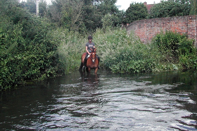
Horse and rider crossing Jouldings Ford from the Berkshire side
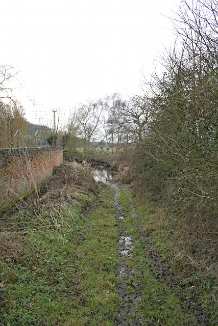
Approach from Jouldings Farm to Jouldings Ford on the Berkshire side
Crossing Jouldings Ford in July 2023
This application on behalf of the British Horse Society was made to Wokingham Borough Council and Hampshire County Council under section 53(5) of the Wildlife and Countryside Act 1981 on 8 May 2013 to modify the definitive map and statement for the county of Hampshire and for the borough of Wokingham by adding:
- a byway open to all traffic along Jouldings Lane in the borough of Wokingham from the turning to Jouldings Farm at SU75296351 in a southwesterly direction to the county boundary at Jouldings Ford at SU75256348, and
- a restricted byway from the said county boundary at Jouldings Ford in a southsouthwesterly direction to the junction with Well House Lane at SU75126322.
Download the application document summary (17MB) reduced file size (4MB).
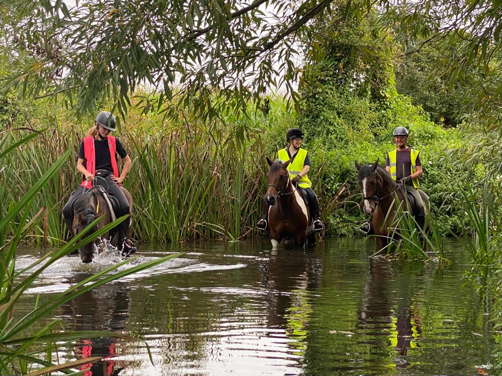
Endurance event using Jouldings Ford on 4 September 2011
Images on Geograph.co.uk
Status: application made on 8 May 2013 and accepted by Hampshire County Council on 6 August 2013 and recorded in its register of applications as application 1131. Accepted by Wokingham Borough Council on 31 October 2014 and recorded in its register of applications; proposed to be disposed of jointly with Hampshire.
Representations made to Secretary of State on 24 June 2016 seeking a direction under paragraph 3(2) of Schedule 14 to the Wildlife and Countryside Act 1981. The Secretary of State on 21 July 2017 directed Hampshire County Council and Wokingham Borough Council to determine the application by 21 March 2018.
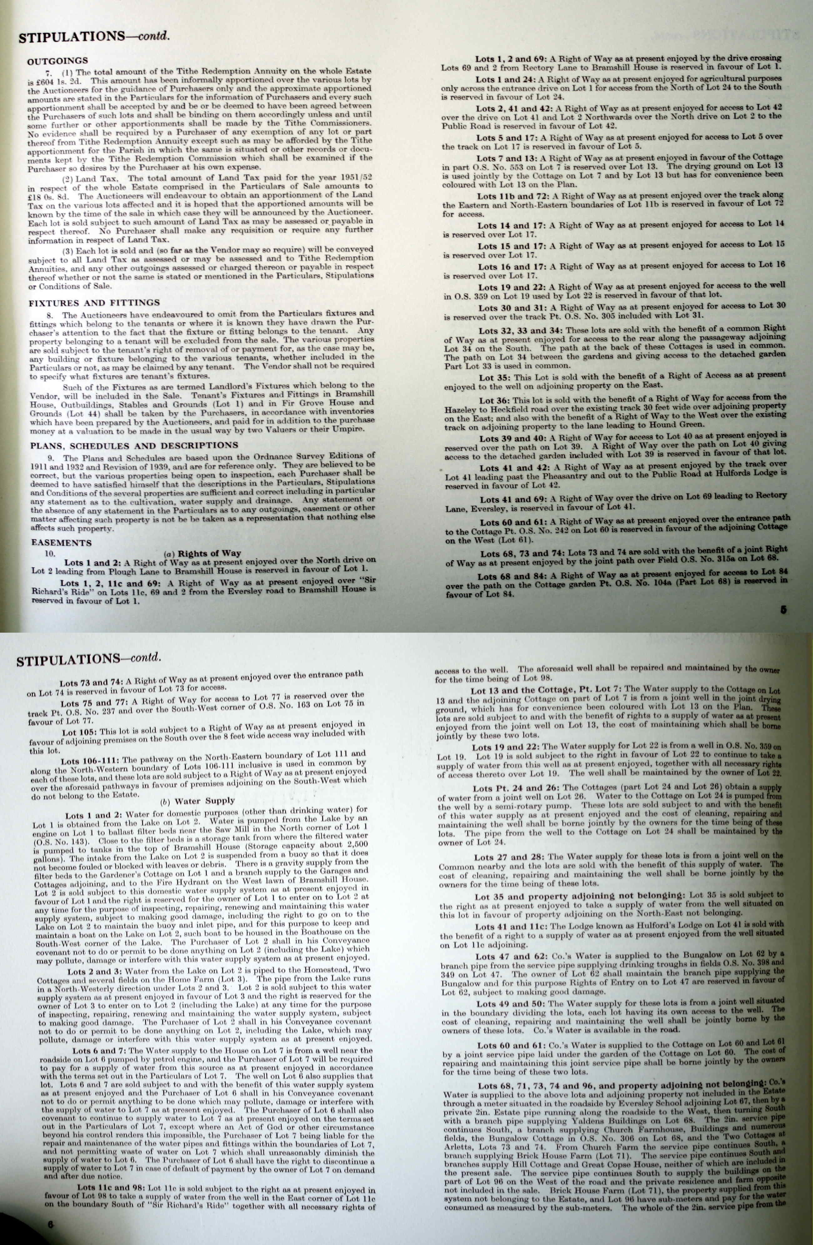
Pre-determination consultation began in late 2017. Response to pre-order objection lodged by Taylor Wessing and Karen Jones, of counsel; stipulations on easements contained in Bramshill Estate offer for sale 1952
Second response to pre-order objection lodged by Taylor Wessing and Karen Jones, of counsel. (The key objection documents to which these responses make a reply can be found annexed at pages 25 and 29 of the report to Regulatory Committee referred to below.)
Application referred to Hampshire County Council Regulatory Committee for determination at its meeting on 14 November 2018: resolved that authority is given for the making of a definitive map modification order to record a byway open to all traffic varying between 7.9 and 13 metres in width, on the route shown between A–B on the location map, and that authority is given for the making of a definitive map modification order to record a restricted byway varying between 7.7 and 13.7 metres in width, on the route shown between B–D on the location map. An advisory was added that the committee wished Wokingham Borough Council to make a traffic regulation order for A–B to prohibit use by motor vehicles.
Definitive map modification order made on 9 April 2019 and published on 25 April 2019. Following objections, the order will be referred to the Secretary of State for confirmation.
A public inquiry was held into confirmation of the order on 20 and 21 July 2022 and 8 August 2022. Download the BHS statement of case (11MB). Also proof of evidence and summary for Hugh Craddock.
Order confirmed by Secretary of State in a decision (ROW/3271783) dated 14 December 2022.