Mid Surrey BHS TREC 2014
The Mid Surrey BHS TREC took place at the Mid Surrey Pony Club field at Walton on the Hill, Surrey, on the weekend of 5 and 6 July 2014.
- results (including POR scores in detail)
- organiser's report
- revised POR report, with overview commentary and notes on check points and tickets
- temporary availability of mastermaps at L1, L2, L3
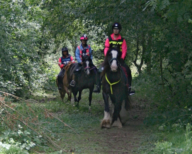
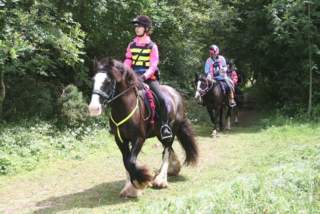
- photography from the pony club ground, including PTV, by MVB Equine Photography
- all photographs from the M25 bridle bridge check point
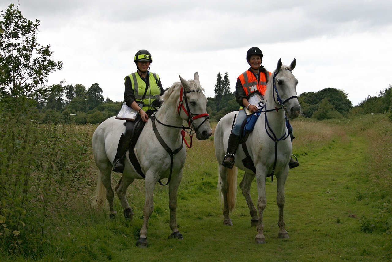
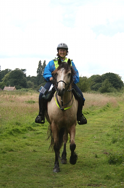
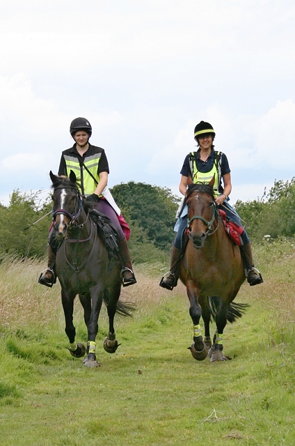
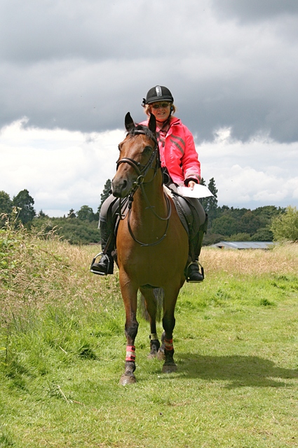
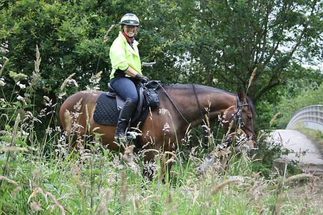
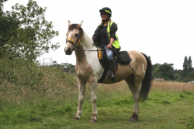
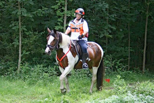
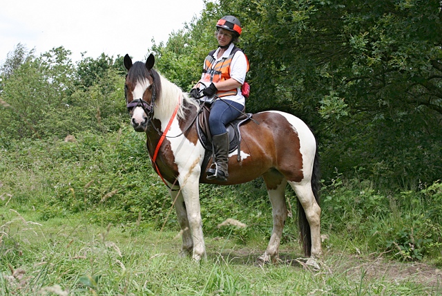
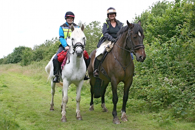
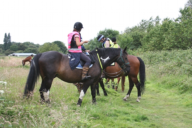
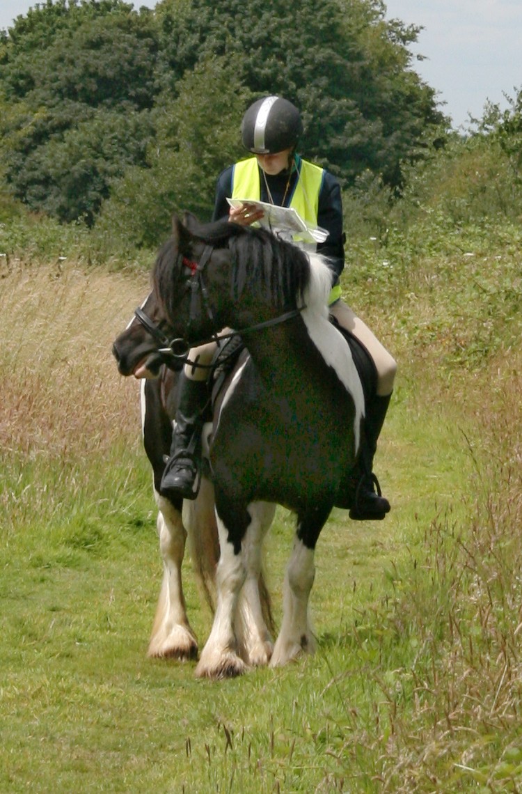
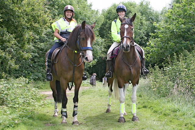
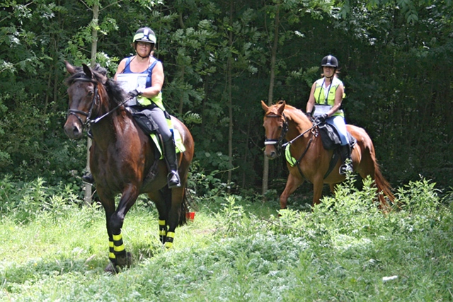
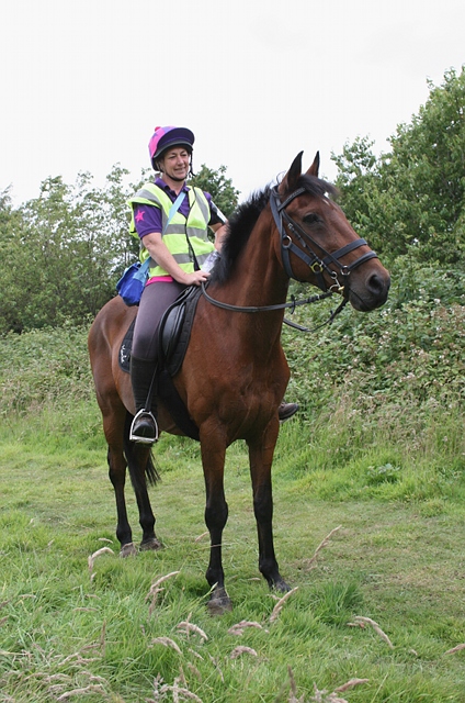
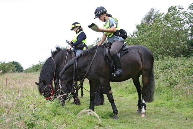
Heather Mcleod riding Claypark Mr Podd and Mary Lazarus riding Bugsy at the M25 check point on Walton Heath on the Level 2 POR.
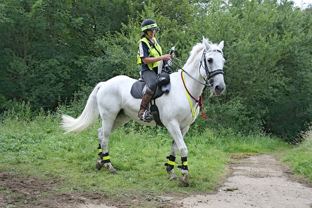
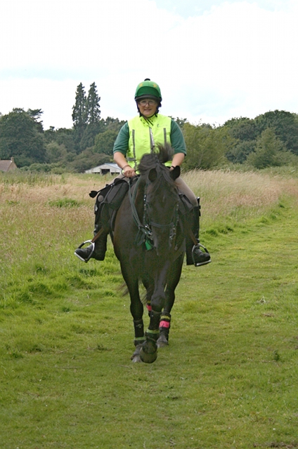
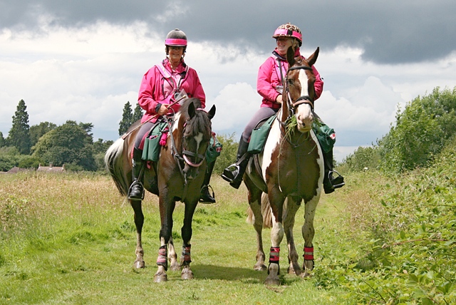
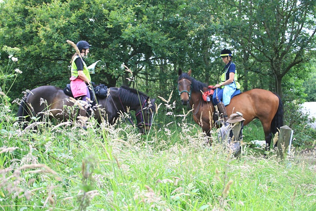
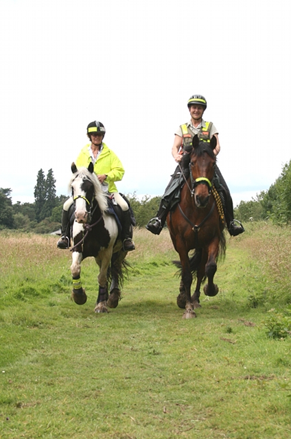
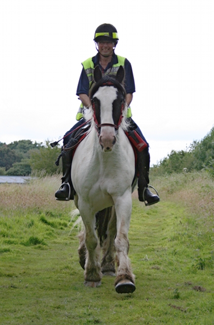
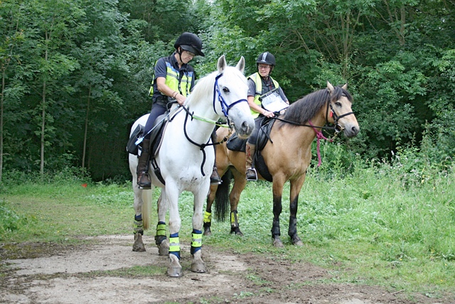
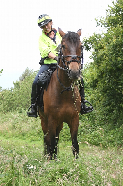
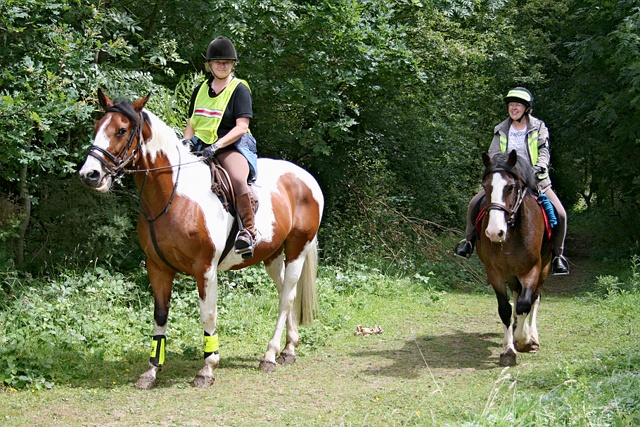
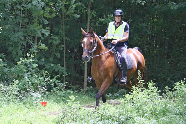
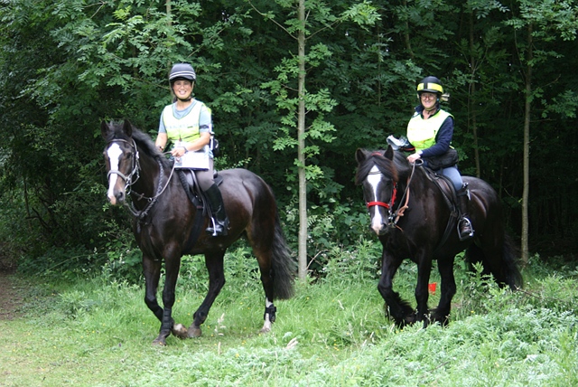
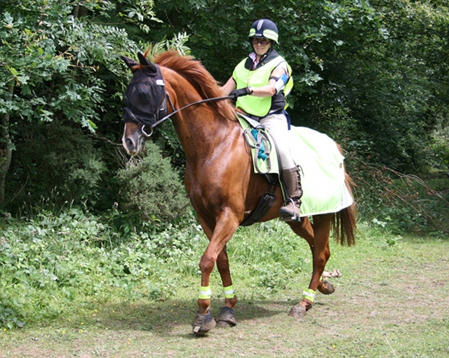
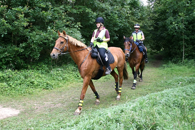
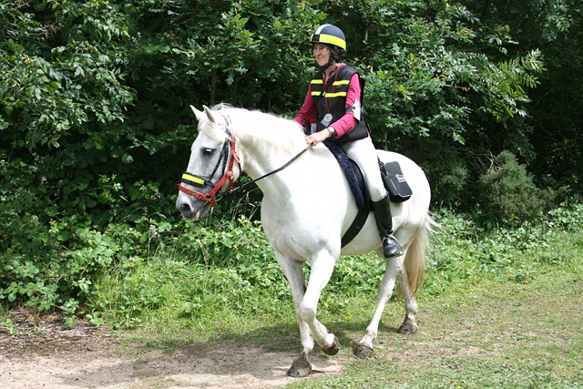
Photos from the Mid Surrey TREC 2014
Informal photos taken at the M25 bridle bridge checkpoint. Emails of original photos available free on request (c.4–8MB).
The POR: L2/L3 M25 check point (Saturday) |
||
 |
 |
 |
| 4 | 6 | 7–8 |
|
 |
 |
| 10–11 | 12 | 13–14 |
 |
 |
 |
| 13–14 | 16–17 | 18 |
 |
 |
 |
| 19 | 20–21 | 22 |
 |
||
| * | 22 | * |
The POR: L1 M25 check point (Sunday) |
||
 |
 |
 |
| 28–29 | 29 | 30 |
 |
 |
 |
| 30 | 31–32 | 33–34–35 |
 |
 |
 |
| 33–34–35 | 35 | 36–37 |
|
|
 |
| 35 | 36–37 | 38 |
 |
 |
 |
| 39–40 | 42–43 | 44 |
 |
 |
 |
| 45–46 | 47 | 48–49 |
 |
 |
 |
| 48–49 | 50 | 51–52 |
 |
||
| * | 53 | * |
Organiser's report
What a way to run a competition! Everything that could have gone wrong, went wrong for me this year, starting with a week before the competition when the computer has to do a lot of work and then sent out a lot of emails with your times and answering your queries.
On the Monday, I took it into the computer shop where the man took it in and said he would have a look at it and maybe I would be able to collect it after the following weekend (!!!! I thought). I told the man the position that I was in and he then said that he would look at it straight away and tell me if it was anything serious. Fortunately it wasn't serious but Windows needed reloading, so when I picked it up on Wednesday, it was like a brand new machine with all my links and funny ways missing! In the meantime, as I did have Tuesday onwards off work, I had to break into my husband's computer and use that (he wasn't too happy about that!)
On Wednesday, my van decided that it could drive no further and I was unable to get it fixed before the weekend or hire a car or van with a tow hitch, so I was stuck! To my rescue came Steve Moulton, who picked me, all my admin clobber and all the PTV equipment up in his lorry and also put me up for two nights before packing up the PTV and most of my admin clobber on Sunday evening, as he had other things to do that evening. He deposited me with Rose Thomas, a new recruit to TREC this year and she very kindly put me up on Sunday night, then waited with me for the skip man to remove the skip from the field, then took me back to her place, transferred my stuff into her car, gave me some lunch, took me to Chelmsford to finally pick up a hire car and then do the reverse the following week when it was time to return the hire car. So if it wasn't for the generosity of these two people, I would probably have had to cancel the whole event. I'm not trying to make excuses for the delay in writing this report, but mainly this is why it is late as I have spoken to most of the people who judged and a lot of the competitors since the event anyway.
So finally, having arrived at the venue at about 4pm, Zoe White our PTV co-ordinator or chef de piste as she will be known as in the future and dedicated competitor Graham Clack had organised the venue and were busy building the PTV course. Steve and I went to help them while Rose set up her corral and got her horse and dogs settled. Then after a splendid meal of pan fried salmon with long stem broccoli, asparagus and Jersey Royal potatoes knocked up by Steve, we met up in the barn to put the competitor packs and the following day's clipboards together.
On Saturday, after listening to just the right amount of rain coming down during the night, we woke to a pleasant morning and once Helen Hunt, our TD, and my mum, Renate Konn, arrived to run the map room with Steve and Rose to help her and also do the Equipment Check, I took over mum's poor little car (which didn't quite know what had hit it) and used it to place the judges out on the Level 2 and 3 POR course. Please have a look at our traceur's report for more details of the POR as I am just going to refer to the check points and who was looking after them.
Zoe took Jim and Caroline Bowers out to check point 2, Mill Way, while I took Helen out to Headley Heath with a promise of taking over from her once I had placed everyone else! I then placed tickets at Tye Lane, which was to be check point 2 for the level 1s on the Sunday, and another ticket on a difficult to find parallel track on Headley Heath, before picking up Lisa Geer. Lisa was acting as our appointed competent person and not competing this year because her horse Chatty was unwell, while Jacqui Peterson was competing in the level 1 on the following day, were taken to look after the vet check and check point 4. This was at Little Heath Farmhouse which belongs to another first time competitor, Jo Ayley. Jo was only talked into entering on her Arab, Milly, the previous week when Hugh and I went to see her about the possibility of using her hosepipe for the vet check watering supply.
I also picked up Rose and my mum, who were going to be a manned ticket for Level 3 at Kemps Farm and also give them their grid reference test sheets. Unfortunately, a vital clipboard got left behind and I had to go back to collect it and ask Rose and mum to hold the competitors there, which they did, as I also had to place Steve, his dog Lady and Janice Bridger, one of our few volunteer judges out on the final checkpoint for level 2 on the way. Hugh was looking after his own check point on an M25 bridge just before crossing over onto Banstead Heath.
Having restarted all the level 3s, I was able to bring Rose and mum back to the venue before disappearing again to look after the final check point for level 3, ending at The Blue Ball, a former pub at the end of their bearings test.
After everyone had got back safely, Helen and Joy Taylor, who was for the first time ever competing at one of our competitions (she is usually the TD), input the scores and were able to produce provisional results for the POR for levels 2 and 3 which were discussed during our evening social, this year catered by The Chicken Shack. The Chicken Shack also provided all the judges' lunches and other refreshments to competitors over the weekend.
Sunday was level 1 day and CoP and PTV day for all the levels. This year we had very few judges for some reason. It didn't help that some people who had volunteered to come and help on the Sunday, had texted in over Saturday night to say that they would now not be coming. So while we had plenty of people to judge the level 1 PTV, I had to rely on the good nature of the level 2s to judge level 3 and the level 3s to judge level 2, which is not something that I would normally do, but everyone was very good about it and I thank you all.
For the level 1 POR, I have to thank the following people: Anna Bulmer — Equipment Check, Janice Bridger and Renate Konn — Map Room, First time judge, Sue Baker got thrown in the deep end and taken out to Tye Lane, Hugh was back up at the M25 bridge and Bain McLeod was on his own on Banstead Heath, not only running the check point but helping competitors cross the busy road afterwards.
The CoP was judged by the same people all day — Caroline and Bronwen Barton together with Sarah Reith. The PTV was judged mainly by competitors in other levels, who were often judging two or three obstacles. These people include Katie Holmes, Kate McMorris, Steve Moulton, Helen Martin, Mary Weston, Liz Beddows, Becca Champion, Jill Perry, Kay Kitson, Vicki Glynn, Amanda Marfleet, Graham Clack, Jenny Snowdon, Renate Konn, Zoe White, Meredith Baker, Sue Baker, Janice Bridger, Heather McLeod, Mary Lazarus and Natalie Douglas.
Graham Clack, Zoe White and Steve Moulton mainly cleared away the CoP and PTV course. I'm sorry if I have left some people out here, but I was, at the time, answering competitors questions while the scoring was being finalised. Helen Hunt and Joy Taylor were working hard at the computer to do this and for the first time ever, we actually managed to have a prize giving at a reasonable time of day!
Meredith Baker not only competed in and won the level 3 Individual but judged some of the level 1 and 2 PTV and also managed to take some great photos of them doing a variety of obstacles. Please do go and have a look at them. She is not charging for her pictures, but hoping that you will donate to her Just Giving page. She is trying to raise funds for the GB TREC Squad as she is on the Young Riders' team and will be heading to Italy this September. Our team is totally self-funded and I know that it will cost each person £3,000 to go and represent their/our country, so please give generously if you can. If you are not on Facebook, but want to see the pictures she has taken of you, please send your your competitor number to Meredith and she will send over small watermarked copies for you to see. The email address is meredithvbaker AT hotmail.co.uk. Hugh Craddock took some photos at the M25 bridge where his check point was and these have come out really well. You can view these above and Hugh is happy to supply you with photos at no cost.
Anyway, I would just like to thank you all for coming to our TREC. It was a lovely venue with some fantastic hacking on the POR, thank you Hugh for designing the POR routes and a very interesting PTV course, designed and masterminded, as always by Zoe White.
Jenny Snowdon
Secretary and Organiser
Traceur's report
|
Sometimes, the challenges on a POR turn out to be nothing of the sort, and everyone gets it right. And other times, what seems to the traceur to be straightforward turns out to be anything but. And just occasionally things turn out as planned. This year was a bit of everything. When I put myself down for the check point at the M25 bridle bridge on Walton Heath, I thought it would be pretty routine, with perhaps a few missed tickets to note. But I was wrong. What happened was that I assumed that levels 1 and 2 would turn off bridleway 477 at the gap in the fence into the field (assuming that they found it at all: the previous footpath 96 is hardly passable to horses, and the alternative is quite a long way round), and pick up the narrow path on the left side of the overgrown hedge, which inevitably leads across the exchange land and into the check point. But many, perfectly rationally, started on the right side of the hedge (actually now a narrow strip of woodland). Given that they soon needed to turn left, they should have headed through a passage after about 50m to pick up the path on the other side (and at level 2, they would have scored ticket no.7, but which was disregarded at this level, intended for level 3 only). But if they missed this passage, there was no further opportunity, and they followed an increasingly overgrown path north to hit bridleway 100 running parallel to but south of the motorway. After that, they were pretty much committed to wrong route into the check point — although some tried a last-minute correction just short of the check point which in at least two cases was spotted. So the M25 check point turned out to be a lot more interesting than I expected. |
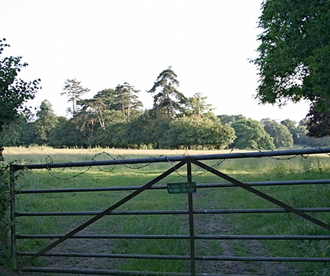
The new common land given in exchange south-east of the M25 bridge: there are few paths on these former fields |
|
Whereas the final check point at Dorking Road (the penultimate check point at level 3) was intended to be challenging, and so it was. There is a report and photo below, but suffice to say that, coming right at the end of the POR, many competitors got this wrong, and it was a severe test for level 1. So was it too harsh? No, I don't think so, because whether riders got it right or wrong, they could all see the check point, and if they'd made it this far, they weren't now going to get lost or head off in the wrong direction. It was a useful learning experience. I was a bit surprised too that level 3 riders missed a disguised manned ticket at Kemp's Farm, riding the wrong side of a tree in the field. More about this below. |
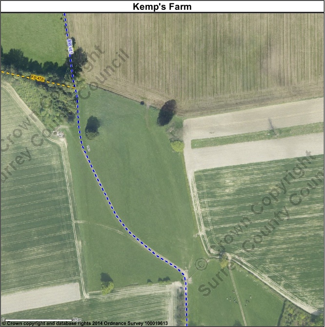
Manned ticket at Kemps Farm: aerial view. The bridleway runs west of the field tree: riders took the more obvious path to the east |
|
Some riders did get lost elsewhere on Walton Heath or Banstead Heath, and a number appeared to have crossed Dorking Road on bridleway 86, south-west from the check point. That's a pity (particularly as the crossing was unstewarded, and riders missed some superb riding up to the check point), but the navigation on the heaths was not specially demanding. The faster speeds (9kph at level 1, 10kph at level 3) probably meant competitors felt under pressure to make progress, but the map here really does reflect the mix of woodland and open space, and most of the paths marked on the map exist on the ground and vice versa. In short, it wasn't easy, but it would have been hard to make it easier, and to do so would have deprived competitors of the best of this lovely environment. We'd like particularly to thank the Banstead Commons Conservators, the National Trust and the Walton Heath golf club for their kind co-operation in the arrangements for this year's POR. However, the entire route was along public paths or across access land with a right of access for horse riders. Much of this year's POR route was common to all three levels, and all riders exited the Mid Surrey pony club field through an opening in the south-east corner, to join bridleway 506. This enclosed and shady path soon heads past the junction with bridleway 70 and the motocross circuit in the adjacent field and so into and through the M25 tunnel. A steady ascent through equestrian pastures takes riders up to Church Lane in Headley. Here, the routes diverged, with level 1 riders uniquely turning left for about 1 km, to rejoin other routes at the mouth of Tye Lane, and levels 2 and 3 right, past the Cock Inn and St Mary's church, and soon turning left into and down the quiet Slough Lane to the junction of Slough Lane with Langley Lane and Tumber Street. Then along Langley Lane, a byway closed to motor vehicles past the Nower, a nature reserve, soon crossing Mill Way and along the adjacent horse margin to checkpoint 2 for levels 2 and 3 at the junction with bridleways 510 and 511 This first check point was sited for convenience, and no-one was expected to be wrong routed, and indeed, no-one was. |
Mill Lane check point at levels 2 and 3 |
|
The route continues along bridleway 510, with a swathe of woodland cleared on the left hand side, and then through beech wood to emerge at Mickleham gallops, an unusual plateau of grassy chalkland with an opportunity of a canter. It was important to keep right here, and leave the single strand wire fence on the left. Riders turned sharply round to the right at the end of the gallop, turning left at two successive path junctions to join Stane Street, Downs Road or Old London Road: whichever, this is the course of the Roman Road from London to Chichester, which adopts a more sinuous route as it drops off the downs to find its way through the Mole Gap. It's not very impressive here, but the sunken section adjacent to Juniper Hill House may be original. This leads fairly gently down to Headley Lane. |
Mickleham gallops (riders should have kept right of the fence on the left) |
|
Riders turned left up Headley Lane for around 500m, passing Juniper Hall field studies centre on the right, then right up a bridleway which follows Juniper Bottom all the way to Boxhill Road at the top (an ascent from Headley Lane of over 100m). Then left along Boxhill Road, which is a quite busy approach to Box Hill viewpoint and much used by cyclists (it's part of the Olympic road race route), for 900m, before turning off left along the sealed Headley Heath Approach, which is a bridleway but also an access road to various properties. At the south-west corner of Headley Heath, riders turn through the gate onto the heath, and follow a path roughly along the southern boundary, but with one brief exception, taking the long two sides of a small triangle to arrive at checkpoint 3, and the possibility of wrong-routing if the short side of the triangle were used. Only one level 2 individual, and one level 2 pair, actually wrong-routed, while the level 3 pair managed to complete this 8km section precisely on time. The path here crosses several valleys, before a turn is taken left, north, to the main heath car park. A dog leg in the route takes riders from one parallel path to another, and a ticket (none missed this), shortly before crossing Headley Common Road. There is then another dog leg, using a drive across the common to White Lodge and Great Hayes, and a further ticket (3 level 2 individuals and 3 pairs missed this one), before rejoining the L1 route at the mouth of Tye Lane. This was also a check point on the Sunday for level 1 only, and 3 level 1 individuals and 2 pairs wrong-routed in. |
Check point (L1) at Tye Lane |
|
Tye Lane is a delightful wooded bridleway running north-east towards Walton on the Hill, but our route forks right over Queen's Wood to cross the Dorking Road and onto Little Heath, and shortly to check point 4 for levels 2 and 3, and a vet check. No-one wrong-routed (that would have been difficult!), but a number of riders arrived quite late, perhaps having experienced difficulty crossing the Dorking Road, or had to slow for walkers and cyclists on Tye Lane. The route turns right onto Buckland Lane, a part byway and part unsealed road leading down to the Reigate Road. However, level 3 riders branched off here down the steep bridleway, while levels 1 and 2 continued along the top of the scarp following bridleway 477 to the M25 check point. The L3 route leaves the L1 and L2 path at the top of Buckland Lane (an unsealed green lane) and descends steeply down the scarp and along a narrow hedge-lined green path. On emerging into a field north of Kemp's Farm, riders are faced with a track across the field which is direct, but to the east of the bridleway, which (when I rode that way recently) was only faintly visible. There is a tree just ahead: riders who passed to the left were wrong-routed, those to the right right-routed. |
Kemp's Farm: the way ahead from the bottom of the enclosed path off the scarp: the field tree lies ahead, the correct route is to the right. |
|
Riders continued along Rectory Lane, a very quiet country lane (it's a dead-end) with nice houses fronting on to strips of common land bordering the lane, past the hen-hut, crossing the railway, with its traditional gate keeper's cottage using the level crossing with lights and automatic half-barriers, and so up to Buckland green and past the pond and towered barn to the A25 Reigate Road. Level 3 riders had been given a grid references test to complete en route, and the first grid reference was the nameplate for Slough Lane on the north-east corner of the green. At Buckland village, riders turn right onto Reigate Road, where there is fair visibility but plenty of traffic, and left after about 50m onto Old Road past the old post office, and immediately, left into Dungates Lane, a sealed lane and bridleway. This continues past Yewdells and the diminutive Buckland windmill, past a gate with a notice which was the second grid reference, to Dungates Farm. |
Grid reference 2 (TQ22185047): 'What isn't there through this gate?' The sign reads 'private property no right of way' |
|
The farm was the third grid reference: the farm house is notable for a number of golden retrievers which volubly mark the passage of riders, so the question was what colour animals greeted competitors here. Unfortunately, it seemed that most where absent, since at best, only one emerged, and all competitors were given the benefit of the doubt. After Dungates Farm, the lane becomes unsealed, and continues past the Shag Brook, where horses can pause for water. Then through some fields, where people often walk through the fields instead of on the path (the fields are preferred on the map) to arrive at Reigate Heath by Ivy Cottage, with splendid views of the windmill and golf club house on the highest point of the heath. There was a short detour here to locate a waymark post, then on round the heath on the 'permissive' path which is generally sandy and good for trot or canter. Riders had a short detour from the Flanchford Road car park along a permissive ride across the heath to the fifth tee to count benches (two). And then the final grid reference was the village filling station on Flanchford Road. |
Grid reference 6 (TQ24165042): 'What might you usefully buy here for the journey home?' The expected answer was diesel — or petrol |
|
Then across Buckland Road into Colley Manor Drive, and through a little cut-through onto Cliftons Lane opposite Little Everest, an initially sealed BOAT which then becomes unsealed, passes under the railway line, and becomes a bridleway to run up to the foot of the scarp. There are views ahead to Colley Hill, warning of the ascent ahead. Cliftons Lane then climbs the scarp, quite steeply, performing a hairpin half way up, where there is a short resurfaced section which is quite slippery (a warning was given) to emerge at the top (a climb of about 130m) at Swiss Cottage. Adjacent is a coal tax post, marking the boundary of the former metropolitan police district: this one is the most southerly and also the highest in London. The posts marked the boundary in order to make clear that certain goods imported into the district would attract the tax. Riders turned immediately left along the enclosed bridleway 477 along the top of the scarp. After about 800m, level 3 riders turned right onto an area of exchange common land, which became common in the 1980s in exchange for part of Walton Heath taken for the M25: this area was once two fields. This particular patch is neatly mown by the owner of the neighbouring house, and the route follows a nicely mown 'garden path'. However, those who followed the mown path all the way round would have ended back where they started: instead, riders needed to fork off the path across the unkempt grassland to find the gap in the hedge line. A ticket was placed half way through the old hedge line which divides the two former adjacent fields. Only one individual L3 got this right, with all others both missing the ticket and wrong-routing into the check point (the ticket was intended to ensure that level 3 riders did not turn late off the bridleway: it was not scored against level 2 riders). |
Ticket 7 |
|
Level 1 and 2 riders approached the check point just south of the M25 bridge via a different entry onto the exchange land, from the opposite direction along bridleway 477, about 120m further west. It didn't matter which side of the old hedge line was followed here, provided that those on the east side went through the gap about 50m north to pick up the path on the west side heading west to the check point. Riders at any of levels 1 to 3 who missed this gap and remained on the east side would inevitably have been led north to bridleway 100, and wrong-routed into the check point: many did this at all levels. However, it appears that the level 2 score-sheet was wrongly interpreted, and no riders at level 2 were penalised for wrong-routing. At level 1, 8 individuals and 5 pairs wrong-routed. |
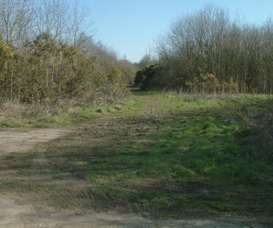
M25 check point: © John Hilton and licensed for reuse under CCL. Note how the vegetation has encroached since this photo in 2007. |
|
Riders followed a common route back from the M25. The bridle bridge over the M25 spooked some horses unfamiliar with the high speed traffic roaring underneath, and some dismounted to use the mounting blocks on either side (formerly overgrown: see the bridge just six years ago here, and ludicrously placed right next to the bridge itself, with a narrow kerb and a drain grid cunningly placed immediately opposite). A short spur brought riders to the service road on the south side of Walton Heath golf club, where they should have turned sharp right along it, bearing round to the left by the field toilet cabin (presumably for the use of members on the course: Walton Heath is an upmarket sort of course) with the golf course now in view. A well worn track projected forwards out of the trees, soon joining the bridleway across the golf course, where riders turned right: it was disappointing to see that three riders went straight on here, across the fairway ahead, despite instructions not to do so. The bridleway heads east before arriving at the metropolitan police district boundary again, and another pillar and a junction of bridleways. Here, the route turned left, and followed a woodland path fringing the golf course soon to emerge on the southern side of a wide expanse of grassland which is part of Banstead Heath (Walton Heath and Banstead Heath are contiguous: the boundary between them, which is marked by a lines of trees and shrubs, is the old manorial boundary and also the metropolitan police district boundary, and white posts can occasionally be seen along it). This is pretty stunningly beautiful countryside, and quite little known: on the left can be seen extensive heather on the roughs of the golf course, while on the right is sweeping rough grassland with gentle undulations and the occasional tree. On a fine summer's day, it makes for a superb ride. The map marked the route along the edge of the grasslands east of bridleway 87, and a bad ticket no.9 on the bridleway itself penalised those who thought that they should stick to the path: all but 2 scored this bad ticket at level 1, half of the level 2 individuals and 3 level 2 pairs. |
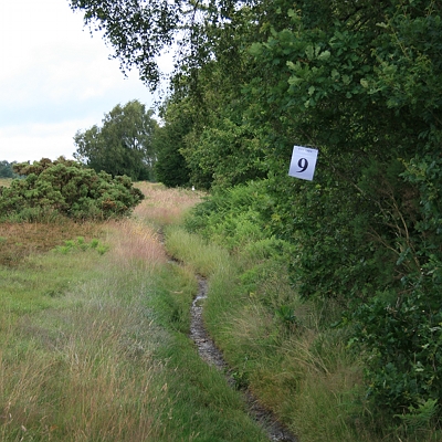
Bad ticket 9: all level 1 riders wrongly scored this |
|
Riders rode in a broad sweep around to the north-east, to pick up another broad grassy sward just outside the route marked on the map as 'the Gallops', an elliptical course which was used for training until soon after the second world war. A good ticket no.8 on the outside of the gallops here rewarded those who did not ride along the gallops itself: remarkably, none missed this. |
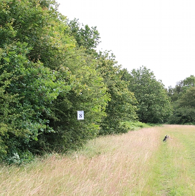
Ticket 8 |
|
Quite a few riders turned too early down bridleway 86, mistaking the thick line of trees for the left turn shown on the map, but the true left turn was another 300m further on, with a locked barrier preventing further progress ahead. |
The gallop at the bw86 crossing: riders needed to dip left onto the gallop here, then out to the right again to pick up ticket 8. |
|
This route took riders through some muddy woodland, with a slight dogleg to the west of the true route of footpath 114 (the latest Ordnance Survey large scale mapping records this perfectly, but some of the tracks shown on the 1:25,000 map no longer exist). The route crossed the gallop, descended downhill, and led to a junction of bridleways at the bottom of the valley. The correct route was half left along bridleway 85, initially uphill, and with a clear path across the grassy heath towards the Dorking Road. However, a final challenge awaited competitors at all levels, because the public bridleway performs an odd dog leg just short of the road, eschewing the direct and well mown path into the check point. Many riders at all levels, perhaps tiring after a long ride, missed this detour through the long grass and were wrong routed: all wrong-routed at level 1, 3 pairs and individuals at level 2, and all at level 3. |
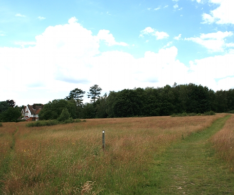
The dog leg on the approach to the final checkpoint: the marker post shows the public bridleway as straight ahead, along neither the main path to right, nor the narrow path to left. |
|
For levels 1 and 2, the POR finished here, and the route back to the pony club field lay across the heath west of the Dorking Road, through Walton on the Hill village, and back along Sandilands Road, Ebbisham Lane and Hurst Road. For level 3, a bearings test lay across this part of the heath, using a combination of public bridleways and permissive rides, terminating at the junction of bridleway 85 and Deans Lane opposite the closed Blue Ball pub. All level 3 riders completed the bearings test successfully, although one individual wrong-routed into the check point. Hugh Craddock Traceur |
Competition enquiries to Jenny Snowdon, tel: 07958 407594 email: jenny.snowdon@btopenworld.com
Enquiries about this page to Hugh Craddock, email: TREC@craddocks.co.uk
Results and report on the Barwell BHS TREC 2013, the Swanworth Farm BHS TREC 2012, Barwell Court Farm BHS TREC 2011, the St Ebba's TRECs 2010, 2009, 2008, 2006 and Balanced TREC 2005
Page last updated: 13 August 2014.